 Massachusetts
State map (simplified) http://geology.about.com/library/bl/maps/blmassachusettsmap.htm
State map http://www.geo.umass.edu/stategeologist/frame_maps.htm
Massachusetts
State map (simplified) http://geology.about.com/library/bl/maps/blmassachusettsmap.htm
State map http://www.geo.umass.edu/stategeologist/frame_maps.htm
The modern Atlantic Ocean apparently started to open around 200 million years ago at the end of the Triassic Period and in the early part of the Jurassic period. Rift Valley deposits from that time are discussed in another writeup. Oddly perhaps, No sedimentary deposits are known in Eastern North America from the 50 or so million years after the ocean started to open. However, beginning in the Early Cretaceous around 130 million years ago, we start to see sediments that were deposited along the Atlantic Margin of North America. The oldest beds are continental lowland deposits -- presumably coastal swamps. These are superseded further East by a patchwork of Upper Cretaceous and later marine and lowland deposits. The general trend is for the oldest deposits to be found furthest West, but there are places where Cretaceous beds lie along the coast and others where Tertiary deposits are found 100km inland from the coast. In most places, the coastal deposits are buried under unfossiliferous recent debris. Since the coastal plane is generally pretty flat, fossiliferous exposures tend to be confined to stream beds, sea cliffs, quarries, canals, and occasionally road cuts. The underlying bedrock consists of metamorphic Iapetus seafloor rocks and possibly some Triassic Basin rocks
The Atlantic Margin beds extend from SouthEastern Massachusetts to Florida. I have -- quite arbitrarily -- excluded most Pleistocene, Holocene and very recent fossiliferous deposits often found in anomalous places such as Canada's Ottawa River Valley and will discuss them in a separate Terrane writeup.
I have also -- again arbitrarily -- excluded deposits along the Gulf Coast similar to those of the Atlantic margin. Those deposits have a more or less uniform stratigraphic terminology that differs from the contemporaneous Atlantic margin deposits. And they serve as a bridge into the Cretaceous Inland Sea deposits of the plains and Rocky Mountain states and provinces. They will be discussed in another writeup.
Ideally, it might be best to put everything into a single table with states across the top from Florida on the left to Massachusetts on the right and geologic age on the vertical axis. But pragmatically that would require a lot of scrolling to get to the right side. So, I'll break this into tractable subsets.
In general, the deposits are unaltered and often poorly consolidated sediments. The terrestrial rocks are siltstones, shales, clays and conglomerates. Fossils consist of a few vertebrate bones and teeth and occasional plant fossils. The marine rocks are shales, sandstones and limestones. Invertebrate fossils are very common. In some places, marine vertebrates and fish teeth and bones are quite common.
Atlantic margin rocks in New England and New York exist only along offshore islands and a small area in SouthEastern Massachusetts. Where present, they are usually buried under glacial debris and are very poorly exposed. Known exposures of Cretaceous beds are on Long Island, Staten Island, Block Island and the Elizabeth Islands near the South side of Cape Cod. Eocene deposits are exposed in SouthEastern Massachusetts. Cretaceous, Miocene and Pleistocene exposures occur on Marthas Vinyard. Pleistocene fossils are found on Nantucket.
| Age | New York | Rhode Island | Massachusetts |
| Pleistocene | See Recent | See Recent | See Recent |
| Pliocene | Unnamed beds on Marthas Vinyard | ||
| Miocene | Calvert | ||
| Eocene | unnamed beds | ||
| Cretaceous, Upper | Unnamed beds | Unnamed beds | |
| Cretaceous, Lower | Potomac | Potomac |
Atlantic margin beds are found in New Jersey East of a line from the head of Raritan Bay to the Delaware River at Trenton and thence Southward through Wilmington, Delaware, and Maryland through the North central part of the District of Columbia then South to Smithfield, NC.
| Age | New Jersey | Delaware | Maryland-DC Virginia | ||
|---|---|---|---|---|---|
| Pleistocene | See Recent | See Recent | See Recent | ||
| Pliocene | Cohansey Sand | Lafayette | |||
| Pliocene | Norfolk | ||||
| Miocene | Kirkwood Sand | Unnamed Formation(s) | Yorktown | ||
| Miocene | St Marys | ||||
| Miocene | Choptank | ||||
| Miocene | Calvert | ||||
| Eocene | Shark River Silt | ||||
| Eocene | Manasquan Clay | ||||
| Eocene | Vincentown | Nanjemoy | |||
| Paleocene-Eocene | Aquia | ||||
| Paleocene | Hornerstown | Brightseat | |||
| Cretaceous, Upper | Tinton-Red Bank-Navesink-Mt Laurel | Navesink-Mt Laurel | Monmouth | ||
| Cretaceous, Upper | Tinton-Red Bank-Navesink-Mt Laurel | Navesink-Mt Laurel | Matawan | ||
| Cretaceous, Upper | Wenonah | Magothy | |||
| Cretaceous, Upper | Marshalltown | Marshalltown | Severn | ||
| Cretaceous, Upper | Englishtown Sand | Englishtown | |||
| Cretaceous, Upper | Woodbury | Woodbury | |||
| Cretaceous, Upper | Magothy | Merchantville | |||
| Cretaceous, Upper | Magothy | Magothy | |||
| Cretaceous, Lower | Raritan | Potomac | Potomac(Raritan) | ||
| Cretaceous, Lower | Potomac(Patapsco) | ||||
| Cretaceous, Lower | Potomac(Arundel) | ||||
| Cretaceous, Lower | Potomac(Patuxent) |
Limestone Fossiliferous (Igneous/Metamorphic)
The Atlantic Margin formations are found East of the line from Richmond, Virginia to Smithfield, North Carolina. From there the outcrop is offset West to a point SouthWest of Raleigh and then Southwest through Columbia, SC to Augusta, Georgia.
| Age | Formation | |
|---|---|---|
| Pleistocene | See Recent | See Recent |
| Pliocene | Bear Bluff | Layayette |
| Pliocene | Waccamaw | Yorktown |
| Miocene | Duplin,Raysor,Goose Creek | St Marys |
| Miocene | Pungo River | |
| Miocene | Hawthorn | Coosawhatchie,Marks Head,Parachucla |
| Oligocene,Upper | Cooper | Chandler Bridge,Ashley |
| Oligocene,Lower | Cooper | Suwanee Limestone,Lazaretto Creek |
| Eocene,Upper | Barnwell | Tobacco Road Sandstone,Dry Branch,Ocala,Parkers Ferry,Harleyville |
| Eocene,Middle | Castle Hayne,Mcbean,Santee | Orangeburg,Cross |
| Eocene,Middle | Trent | |
| Eocene,Middle | Warley Hill | |
| Eocene,Middle | Congaree sand | |
| Eocene,Lower | Black mingo | Fourmile Branch |
| Paleocene | Beaufort | Snapp,Lang Syne,Williamsburg-Rhems |
| Paleocene | Tuscahoma | |
| Cretaceous, Upper | Peedee | |
| Cretaceous, Upper | Black Creek | |
| Cretaceous, Upper | Middendorf | |
| Cretaceous, Lower | Patuxent |
Limestone Fossiliferous (Igneous/Metamorphic)
The Atlantic Margin beds are found South of a line from Augusta on the Georgia-South Carolina border West to and beyond Montgomery, Alabama. These beds largely use the same nomenclature as the Gulf Margin beds further West.
| Age | Formation |
|---|---|
| Pleistocene | See Recent |
| Miocene | Altamaha-Miccosukee |
| Miocene | Chatahoochee |
| Oligocene | Suwanee |
| Oligocene | Irwinton_barnwell-Glendon |
| Oligocene | Irwinton_barnwell-Marianna |
| Eocene | Irwinton_barnwell-Ocala Limestone-Cooper-Sandersville |
| Eocene | Irwinton_barnwell-Ocala Limestone-Twiggs Clay |
| Eocene | Irwinton_barnwell-Ocala Limestone-Tivola |
| Eocene | Irwinton_barnwell Sand-Ocala Limestone-Clinchfield |
| Eocene | Lisbon-McBean-Claiborne |
| Eocene | Tallahatta |
| Eocene | Tuscahoma |
| Eocene | Hatchitigbee |
| Eocene | Nanfalia |
| Paleocene | Huber |
| Paleocene | Porters Creek |
| Paleocene | Clayton |
| Cretaceous,Upper | Providence |
| Cretaceous,Upper | Ripley |
| Cretaceous,Upper | Cusseta sand |
| Cretaceous,Upper | Bluffton |
| Cretaceous,Upper | Eutaw |
| Cretaceous,Upper | Tuscaloosa |
Limestone Fossiliferous (Igneous/Metamorphic)
The entire Florida Peninsula including the Panhandle is covered by Atlantic Margin beds.
| Age | Florida Peninsula | Florida Panhandle |
|---|---|---|
| Pleistocene | See Recent | See Recent |
| Pleistocene | Miami,Key Largo | |
| Pleistocene | Anastasia Limestone,Trail Ridge | |
| Pliocene | Cypresshead | |
| Pliocene | Citronelle | |
| Pliocene | Intracoastal Limestone | |
| Pliocene | Tamiami | |
| Miocene-Pliocene | Yellow River-Red Bay-Jackson Bluff | Miccosukee-Bone Valley-Tamiami Limestone-Hawthorne |
| Miocene | Alachua | Shoal River,Alum Bluff |
| Miocene | Hawthorne | Chipola-Fort Preston-Coosawhatchie-Statenville-Torreya |
| Miocene | St Marks | Chatahoochee |
| Oligocene | Arcadia | Duncan Church |
| Oligocene | Suwanee | Bryam |
| Oligocene | Marianna | |
| Eocene | Crystal River | Ocala |
| Eocene | Wells-Inglis | |
| Eocene | Avon Park Limestone |
Limestone Fossiliferous (Igneous/Metamorphic)
Massachusetts
State map (simplified) http://geology.about.com/library/bl/maps/blmassachusettsmap.htm
State map http://www.geo.umass.edu/stategeologist/frame_maps.htm
 Rhode Island
 New York
Generalized Bedrock Geology of NY
New York
Generalized Bedrock Geology of NY
 New Jersey
Simplified map of NJ
New Jersey
Simplified map of NJ
Index to online geology maps of New Jersey
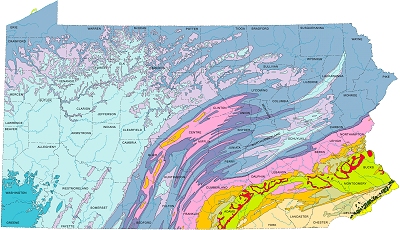 Pennsylvania
Simplified map of PA
Pennsylvania
Simplified map of PA
Digital Geologic map of Pennsylvania
 Delaware
 Maryland
Geologic Map
Maryland
Geologic Map
 Virginia
 North Carolina
Generalized map
North Carolina
Generalized map
 South Carolina
 Georgia
High Resolution map
Georgia
High Resolution map
 Florida
Generalized map
Florida
Generalized map
Copyright 2006-2012 Donald Kenney (Donald.Kenney@GMail.com). Unless otherwise stated, permission is hereby granted to use any materials on these pages under the Creative Commons License V2.5.
This page will have been validated as Valid HTML 4.01 Transitional prior to posting on the web site. W3C Logo Image omitted.
